
Cargando...
Atopa
visualización

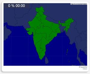
Mapa interactivo de la India en el que se trata de identificar sus estados y territorios.
Las zonas que debes ubicar son: Andhra Pradesh, Arunachal Pradesh, Assam, Bengala Occidental, Bihar, Delhi, Goa ...
Would you know to locate the geographic items you are asked about? You must point out each exact location on the map.
Locate countries are: Map of States and Territories of India, Andaman and Nicobar I ...
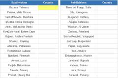
Name the country of the given subdivisions.
It is an educational content by JetPunk, site that contains a wide variety of quizzes.
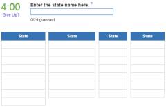
Can you name all 29 states of India?
It is an educational content by JetPunk, site that contains a wide variety of quizzes.
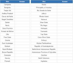
For each subnational division, state and province, name the country in which it is located.
It is an educational content by JetPunk, site that contains a wide variety of quizzes.
Engadir a Didactalia Arrastra el botón a la barra de marcadores del navegador y comparte tus contenidos preferidos. Más info...


